9Example layouts for direction signs in advance of or on a toll road#

The following example direction sign layouts illustrated in figures 9(a)–(g) have been selected to provide guidance on the implementation of the new signage scheme.
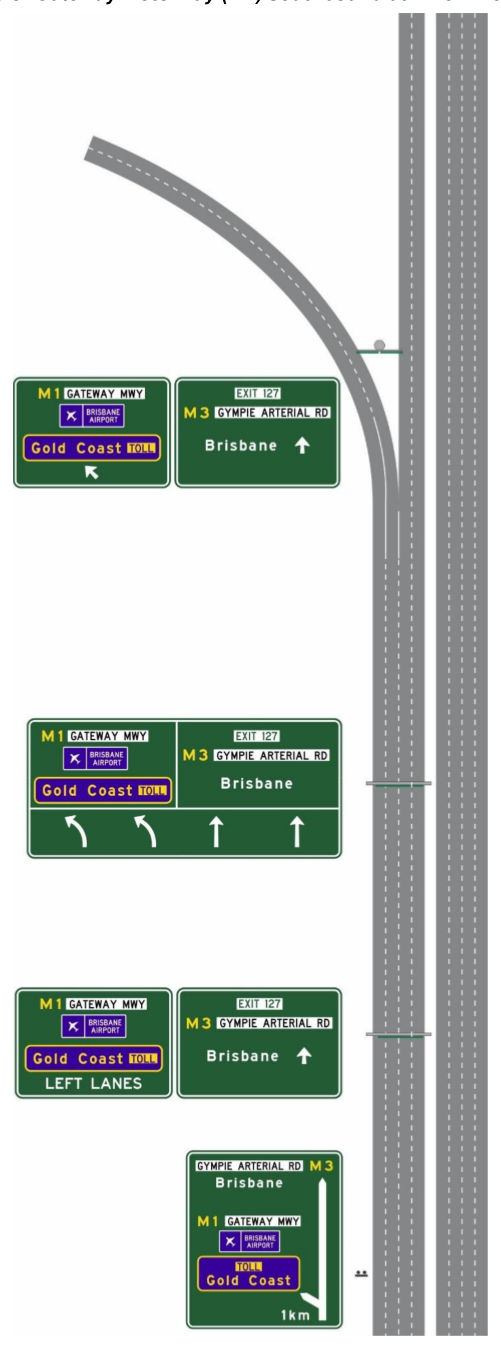
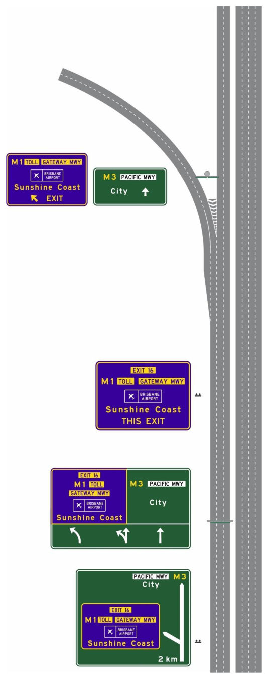
Figure 9(a) – Example of Gateway Motorway (M1) southbound at Pine River Bridge
Figure 9(a) – Example of Gateway Motorway (M1) southbound at Pine River Bridgep. 48
Figure 9(b) – Example of Pacific Motorway (M1 / M3) northbound at the Gateway Motorway (M1)
Figure 9(b) – Example of Pacific Motorway (M1 / M3) northbound at the Gateway Motorway (M1)p. 49

diverge

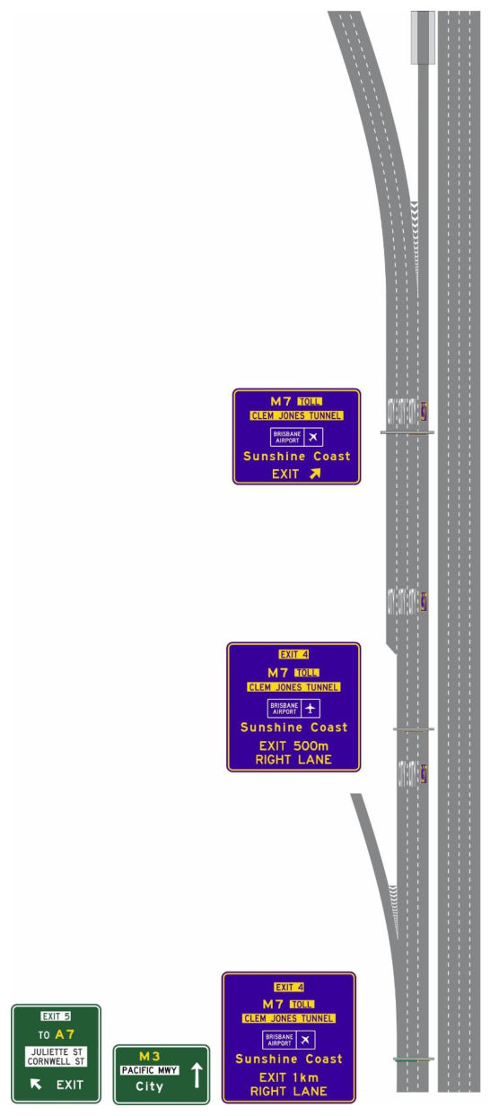
Figure 9(c) – Example of Pacific Motorway (M3) northbound at the exit to the Clem Jones Tunnel (M7)
Figure 9(c) – Example of Pacific Motorway (M3) northbound at the exit to the Clem Jones Tunnel (M7)p. 50
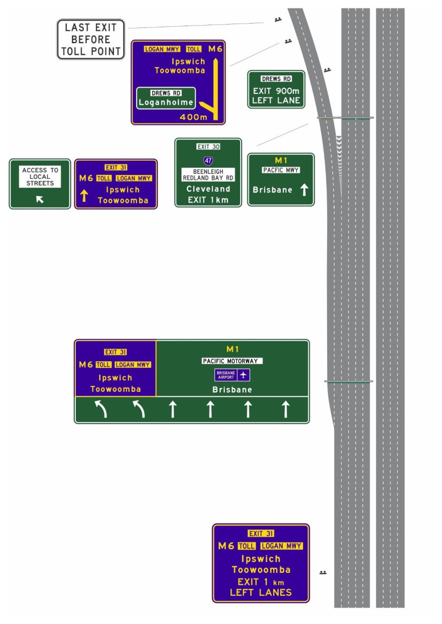
Figure 9(d) – Example of Pacific Motorway (M1) northbound at the exit to the Logan Motorway (M6)
Figure 9(d) – Example of Pacific Motorway (M1) northbound at the exit to the Logan Motorway (M6)p. 51
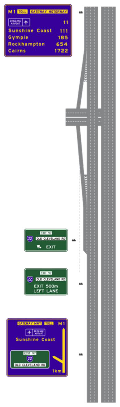
Figure 9(e) – Example of Gateway Motorway (M1) northbound at the exit to Old Cleveland Rd (State Route 22)
Figure 9(e) – Example of Gateway Motorway (M1) northbound at the exit to Old Cleveland Rd (State Route 22)p. 52
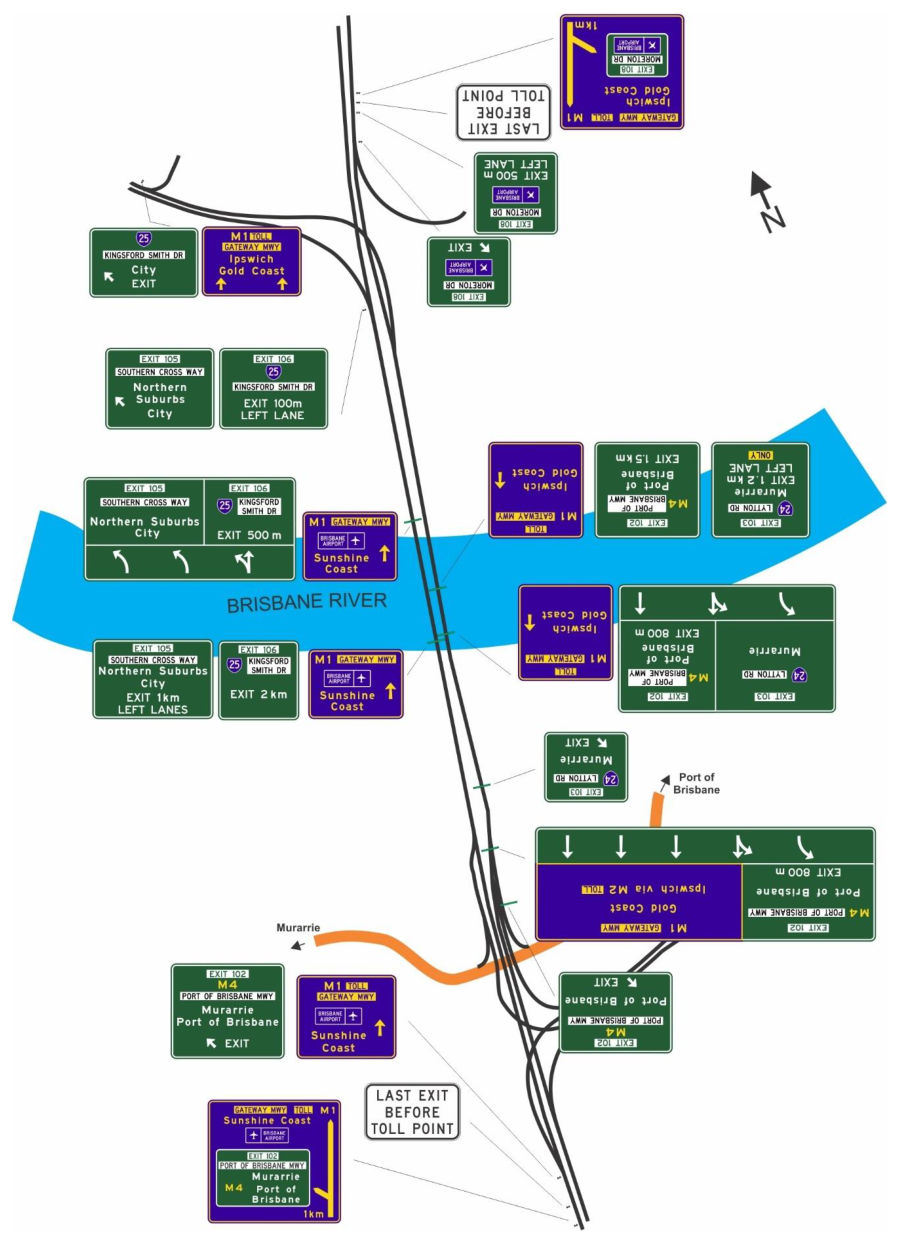
Figure 9(f) – Example of Gateway Motorway (M1) Sir Leo Hielscher Bridge
Figure 9(f) – Example of Gateway Motorway (M1) Sir Leo Hielscher Bridgep. 53
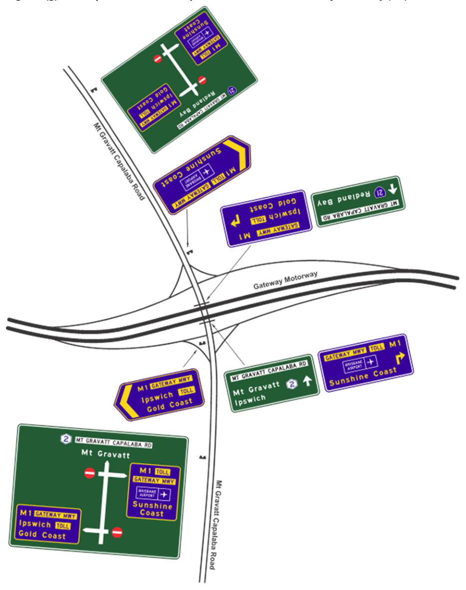
Figure 9(g) – Example of Mt Gravatt Capalaba Road onto the Gateway Motorway (M1)
Figure 9(g) – Example of Mt Gravatt Capalaba Road onto the Gateway Motorway (M1)p. 54
Source: TRUM Vol 3 Part 10 · pages 47–54 Open PDF at this page Search this document